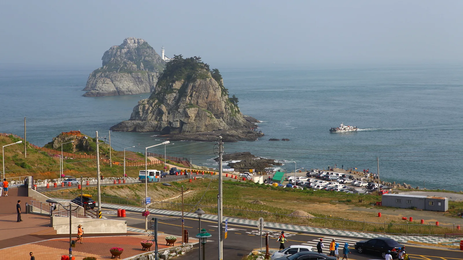
Igidae Park is a cliff-top coastal trail on the Yongho-dong peninsula in southeastern Busan. The path follows the rocky shoreline and looks across the water to Haeundae, the Marine City towers and the Gwangan Bridge. It combines sea views with a real walk. Visitors cross boardwalks, climb stairs and pick their way over rock, which makes it a better fit for a half-day outing than for a quick photo stop.
What the Trail Is Like
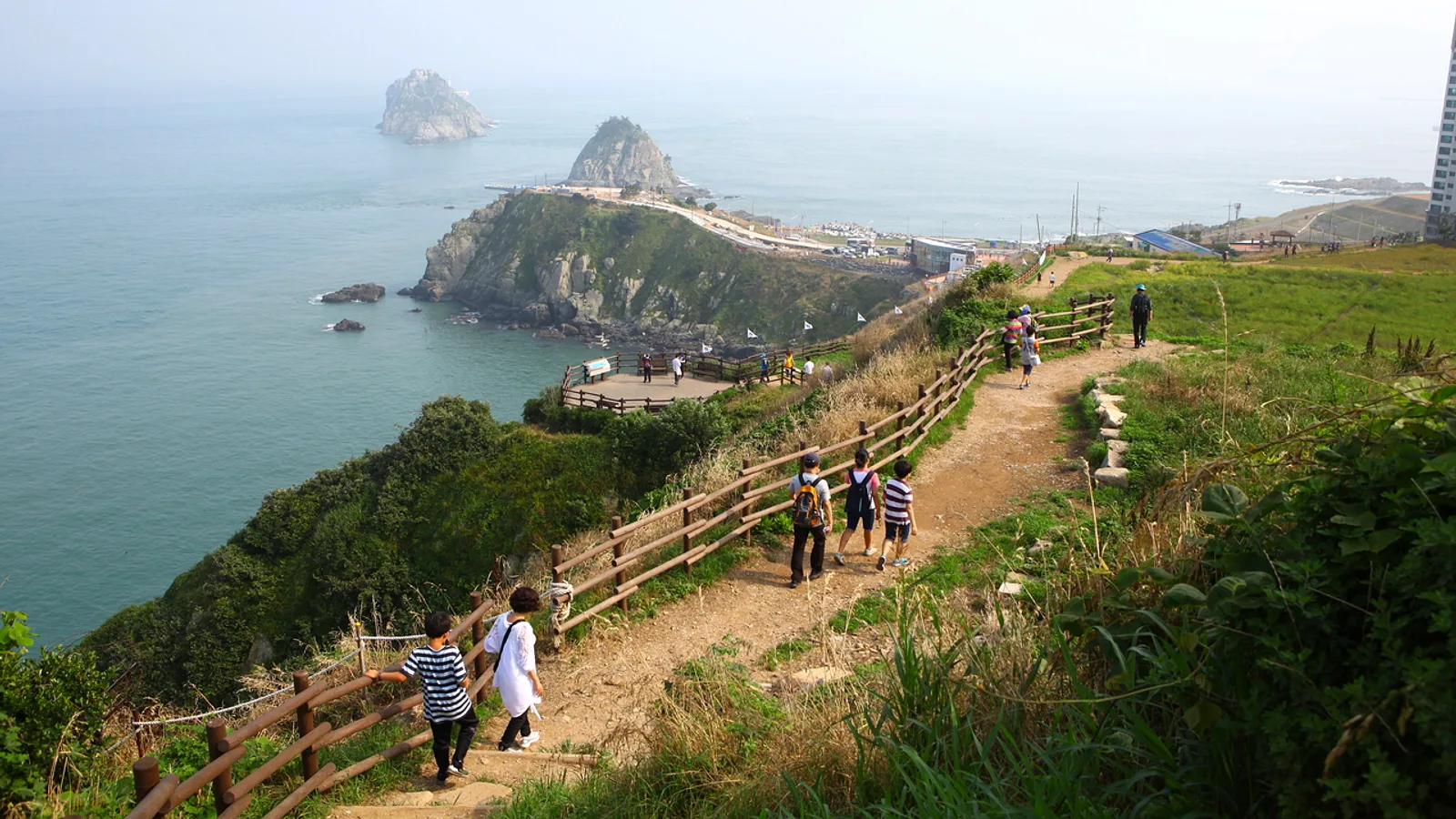
The trail runs roughly from Dongsaengmal, near Yongho-dong, to the Oryukdo Skywalk at the southern tip of the peninsula. The surface changes often along the way.
- Wooden boardwalks and stairs cover much of the route.
- Some sections are natural rock, which can be uneven and slippery when wet.
- The path stays close to the cliff edge, so sea views are almost constant.
- Pace depends on how often you stop for photos, so leave more time than the distance suggests.
Check Naver Map or Kakao Map for the current route and any closed sections. Coastal paths are sometimes shut after storms or high waves.
Oryukdo and the Skywalk
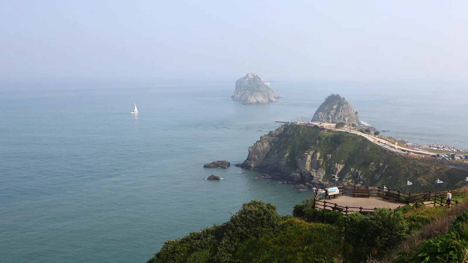
Oryukdo is a small group of rocky islets just off the southern tip. The name is usually explained as "five or six islands", because the count changes with the tide and the angle of view. The islets also mark the boundary between the East Sea and the South Sea, which gives the view some geographic weight beyond its looks.
The Oryukdo Skywalk is the natural end point of the walk. It is the best place to look at the islets and the open water beyond them. Check the official site or Naver Map for current access conditions, as skywalks can close in strong wind or bad weather.
The Marine City Skyline
Across the bay, the Haeundae high-rises and the Gwangan Bridge fill the horizon. The contrast is the main attraction here: a rough, natural shoreline in the foreground and a dense modern skyline behind it.
- Clear days give the sharpest view of the towers and the bridge.
- Hazy days soften the skyline but can still make for atmospheric photos.
- The cliffs and the city appear together in the same frame from many points along the trail.
Best Time to Go
The walk works well at sunset, when the towers face the fading light and the city lights start to come on. A daytime walk gives clearer views of the rock and the water.
- Plan to finish the more uneven rocky sections before dark, since lighting on natural paths may be limited.
- Spring and autumn are generally the most comfortable seasons for a long walk.
- Midsummer can be hot and humid, and winter wind off the sea can be strong.
- Check the weather forecast before leaving, as wind and rain change the experience on an exposed cliff.
Getting There
The usual approach is by subway and bus. Take Line 2 to Gyeongseongdae-Bukyeongdae station, then transfer to a bus toward the Igidae and Yongho-dong area. Route numbers and stop locations change, so confirm them in Naver Map or Kakao Map before you go.
Many visitors walk the trail in one direction and then return by bus from the other end. Decide beforehand which end you want to finish at, and check the return bus options on the map app so you are not stranded at dusk.
What to Wear and Bring
- Shoes with good grip. Sandals and smooth soles are a poor choice on wet rock and stairs.
- A light windproof layer, even in warmer months, because the exposed headland catches the wind.
- Water, since shops along the path may be few.
- A phone power bank, as navigation and photos drain the battery.
- A small bag, keeping both hands free for railings on the stairs.
Tips
- Take the walk slowly. The stairs and rocky sections are tiring, and the trail is not well suited to strollers or wheelchairs.
- Keep well back from cliff edges and wet rock, especially with children, and stay behind any barriers or signs.
- Avoid the trail in typhoon conditions, heavy rain or high waves.
- If you carry food or snacks, take your rubbish with you. Bins may be limited along the route.
- Anyone with allergies or dietary restrictions should bring their own snacks, as food options near the trail may be limited and menus change.
- Check the official site, Naver Map or Kakao Map for the latest access, opening and transport details before you leave.