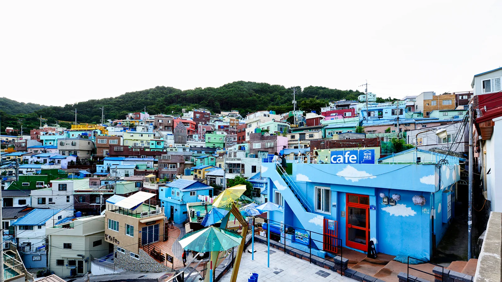
Much of Busan climbs steeply from the harbor, and many of its hillside neighborhoods began as improvised settlements. Refugees arriving during the Korean War built homes wherever they could find space, and the dense, stacked streets seen today grew from that period. These areas are still lived in. They are not theme parks, and visits go better when approached as a walk through ordinary neighborhoods with a difficult history. This guide covers three areas: Ami-dong, Choryang Ibagu-gil and Yeongdo.
Why Busan's hills look the way they do
The slopes above the port were settled by Korean War refugees who needed shelter close to the city and its harbor. Houses were fitted into narrow lots, connected by stairways and alleys that cars cannot enter. That layout explains why these walks involve many steps and why the views are so open: the houses face the water because there was nowhere else to build.
Understanding this makes the neighborhoods easier to read. The uneven rooflines, the patched walls and the tight lanes are products of necessity rather than decoration, and they are someone's home today.
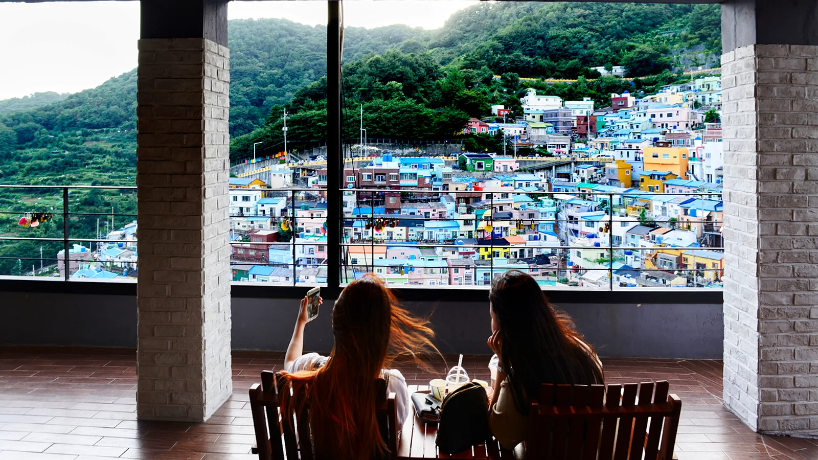
Ami-dong tombstone village
Ami-dong sits next to Gamcheon, which is the better-known neighbor. Ami-dong is often called the tombstone village because houses here were built using stones from a former Japanese cemetery. Stone that once marked graves was reused in walls and foundations during the settlement years.
- A small information centre in the area explains the history. It is worth visiting first, because the context changes how the streets look.
- Look closely at retaining walls and house foundations, but keep the subject in mind: this is a sensitive piece of local history, not a novelty.
- Check Naver Map or Kakao Map for the information centre's current opening status before going.
Choryang Ibagu-gil, behind Busan Station
Choryang Ibagu-gil begins behind Busan Station, which makes it one of the easiest hillside walks to reach by public transport. The route climbs through the slope above the station area.
- The old Baekje Hospital building is one of the landmarks along the way.
- The 168 Stairs are a steep climb, and a monorail lift runs alongside them. Check the official site or a map app for how the lift operates and whether it is available to visitors.
- Viewpoints along the route look out over the port, and the contrast between the container-and-ship harbor and the houses on the slope shows the city's layout clearly.
Because the start is close to the station, this walk suits a short stop between train connections, though the stairs take real effort with luggage.

Yeongdo: Huinnyeoul and Kangkangee Arts Village
Yeongdo is an island district with a working-harbor character. Two places stand out.
- Huinnyeoul is a coastal area on the island. Check a map app for the best way to reach it and for conditions on the day.
- Kangkangee Arts Village lies in a ship-repair district, and its murals are painted into an industrial setting. The name relates to the work of chipping rust from ships, which fits the area's trade.
Expect a different mood from Ami-dong and Choryang. The setting is part shipyard and part neighborhood, so watch for work activity and stay clear of anything that looks like an active work area.
Walking in residential areas
Respect for residents is the main rule across all three areas.
- Keep voices low. Sound carries easily through narrow alleys, and many houses sit directly beside the path.
- Do not photograph doors or windows. Frame photos on walls, murals, stairs and views instead.
- Avoid pointing cameras or phones toward people inside or outside their homes.
- Stay on the marked or obviously public routes and do not enter private yards or stairways.
- Take litter with you. Public bins may be scarce on the slopes.
Getting around and planning
These are three separate outings, and combining all of them in a single day is ambitious given the climbing. Choryang Ibagu-gil is the simplest to pair with arrival or departure at Busan Station. Ami-dong is usually visited together with Gamcheon. Yeongdo works better as its own trip.
Slopes and stairs are the main physical challenge. Wear shoes with good grip, because stone steps and painted surfaces can be slippery in wet weather. Bring water, and expect little shelter from sun or rain on the exposed sections. Routes can be hard for strollers and wheelchairs.
Tips
- Visit the Ami-dong information centre first for context, and confirm its hours on Naver Map or Kakao Map.
- Use Naver Map or Kakao Map for walking routes, as Google Maps coverage in Korea is limited for pedestrian paths.
- Check the official site or a map app for the 168 Stairs monorail lift before relying on it.
- Keep quiet, and never photograph doors or windows.
- Travel light, since the stairs are the hardest part of the walk.
- Choose dry weather where possible, and allow extra time for rests on the climbs.