Aller au contenu
Korea Travel Atlas

Station Euljiro 1(il)-ga

을지로입구

First and last trains

Departures from this station in the official timetable for novembre 2026, by direction. A late train can end short of the terminus; where it goes is shown.

  • Line 2
    Toward Euljiro 3(sam)-ga
    FirstLast
    Weekdays239 trains a day05:3000:44after midnight
    Toward City Hall
    FirstLast
    Weekdays240 trains a day05:3000:49after midnightto Hongik Univ.

Exits: what is nearby and which buses stop

The official data names nearby facilities and landmarks for 9 exits of this station.

  • Exit 1

    Nearby

    • 예금보험공사(본사)Yegeumboheomgongsa(bonsa)
    • 하나은행(본점)Hanaeunhaeng(bonjeom)
    • 한국관광공사(서울센터)Hangukgwangwanggongsa(seoulsenteo)

    Bus routes: 172, 400, 471, 472, 500, 504, N62

  • Exit 1-1

    Nearby

    • 더존을지타워Deojoneuljitawo
    • 기업은행(무교점)Gieobeunhaeng(mugyojeom)
    • 부림빌딩Burimbilding
    • 서울특별시청Seoulteukbyeolsicheong
    • 신용회복위원회(서울)Sinyonghoebogwiwonhoe(seoul)
    • 태평로파출소Taepyeongnopachulso
  • Exit 2

    Nearby

    • IM뱅크(서울영업부)IMbaengkeu(seouryeongeopbu)
    • 국민건강보험공단(종로지사)Gungmingeongangboheomgongdan(jongnojisa)
    • 영풍문고Yeongpungmungo
    • 예금보험공사(본사)Yegeumboheomgongsa(bonsa)
    • 한국관광공사(서울센터)Hangukgwangwanggongsa(seoulsenteo)

    Bus routes: 1150, 162, 173, 201, 5007, 506, 702A(서오릉), 702B(용두초교), 705, 8100, 9003, 9300, 9301, M4101, M4102, N15, N62

  • Exit 3Accès fauteuil roulant : oui (selon OpenStreetMap)

    Nearby

    • 광교Gwanggyo
    • 대만관광청(서울사무소)Daemangwangwangcheong(seoulsamuso)
    • 신한은행(광교영업부)Sinhaneunhaeng(gwanggyoyeongeopbu)
    • 신한은행광교빌딩Sinhaneunhaenggwanggyobilding
    • 청계천 방면Cheonggyecheon Bangmyeon

    Bus routes: 103, 143, 151, 162, 172, 173, 201, 262, 401, 406, 701, 7017, 7021, 7022, 704, 9401, G8110, N15, N62

  • Exit 4Accès fauteuil roulant : oui (selon OpenStreetMap)

    Nearby

    • SKT빌딩SKTbilding
    • SK텔레콤본사SKtellekombonsa
    • 교원내외빌딩Gyowonnaeoebilding
    • 국민은행(명동영업부)Gungmineunhaeng(myeongdongyeongeopbu)
    • 삼성전자서비스(을지로센터)Samseongjeonjaseobiseu(euljirosenteo)
    • 서울지방고용노동청Seouljibanggoyongnodongcheong
    • 우리은행(한화지점)Urieunhaeng(hanhwajijeom)
    • 하나은행(영업2부지점)Hanaeunhaeng(yeongeop2bujijeom)
    • 한화빌딩Hanhwabilding

    Bus routes: 100, 152, 202, 261, 471, 472, 501, 701, 7017, 7021, G8110, N30

  • Exit 5

    Nearby

    • 기업은행(본부기업영업점)Gieobeunhaeng(bonbugieobyeongeopjeom)
    • 남대문세무서Namdaemunsemuseo
    • 명동성당Myeongdongseongdang
    • 서울 YMCA 스포츠센터Seoul YMCA Seupocheusenteo
    • 서울대교구카톨릭회관Seouldaegyogukatollikhoegwan
    • 센트럴빌딩(명동)Senteureolbilding(myeongdong)
    • 전국은행연합회Jeongugeunhaengyeonhaphoe
    • 하나은행(영업부지점)Hanaeunhaeng(yeongeopbujijeom)
    • 하나은행화페전시관Hanaeunhaenghwapejeonsigwan

    Bus routes: 100, 105, 152, 202, 261, 472, 6015, 6021, N30

  • Exit 6Accès fauteuil roulant : oui (selon OpenStreetMap)

    Nearby

    • 명동파출소Myeongdongpachulso
    • 유네스코회관Yuneseukohoegwan
    • 주한중국대사관Juhanjunggukdaesagwan
    • 한국전력(서울본부)Hangukjeollyeok(seoulbonbu)

    Bus routes: 1005-1, 1150, 5000, 5005, 5007, 5500-1, 5500-2, 6015, 6021, 7900, 8100, 8800, 9000, 9000-1, 9000-1A, 9007, 9300, 9301, 9401, M4101, M4102, M4108, M4130, M5107, M5115, M5121

  • Exit 7Accès fauteuil roulant : oui (selon OpenStreetMap)

    Nearby

    • 롯데백화점(연결통로)Rotdebaekhwajeom(yeongyeoltongno)
    • 롯데시네마Rotdesinema
    • 롯데에비뉴엘(본점)Rotdeebinyuel(bonjeom)
    • 롯데영플라자(본점)Rotdeyeongpeullaja(bonjeom)
    • 롯데호텔(서울)Rotdehotel(seoul)
    • 신세계백화점Sinsegyebaekhwajeom
    • 한국은행Hangugeunhaeng

    Bus routes: 100, 143, 152, 202, 261, 262, 405, 501, 701, 7017, 7021, 702A(서오릉), 702B(용두초교), 705, 9701, N15, N30

  • Exit 8Accès fauteuil roulant : oui (selon OpenStreetMap)

    Nearby

    • 더플라자호텔Deopeullajahotel
    • 롯데문화센터Rotdemunhwasenteo
    • 롯데호텔Rotdehotel
    • 신한은행(서울롯데점)Sinhaneunhaeng(seoullotdejeom)
    • 프레지던트호텔Peurejideonteuhotel

    Bus routes: 6701

Facility names are published in Korean only. The romanised form beside each is generated from the Korean and is not an official English name; show the Korean to station staff or a taxi driver.

Accès fauteuil roulant : oui (selon OpenStreetMap)

OpenStreetMap

Lieux à environ 1 km

Distances à vol d’oiseau depuis la sortie répertoriée la plus proche ; le trajet à pied est plus long.

  • 400 m à vol d’oiseau, environ 8 min à pied (estimation)

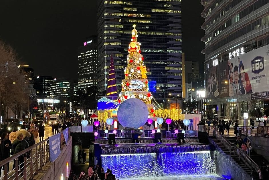
    Cheonggyecheon StreamPhoto KTO

    NatureSite NaturelSeoul

    Cheonggyecheon Stream

    청계천

    Cheonggyecheon Stream is an 11-kilometer ecological urban waterway flowing through central Seoul, featuring restored historic stone bridges, stepping stones, and lantern art festivals.

  • 520 m à vol d’oiseau, environ 10 min à pied (estimation)
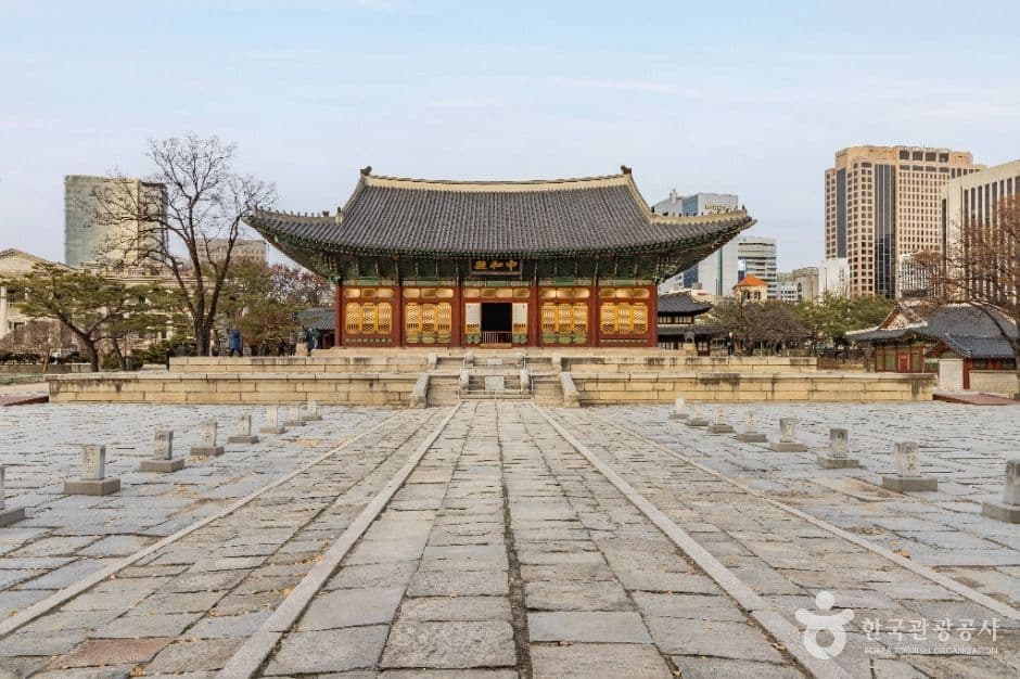
    Deoksugung PalacePhoto KTO

    PatrimoinePalais RoyalSeoul

    Deoksugung Palace

    덕수궁

    Deoksugung Palace, located opposite Seoul City Hall, is a historically pivotal royal palace where traditional Joseon wooden halls stand shoulder-to-shoulder with neoclassical Western stone architec...

Lignes de cette station