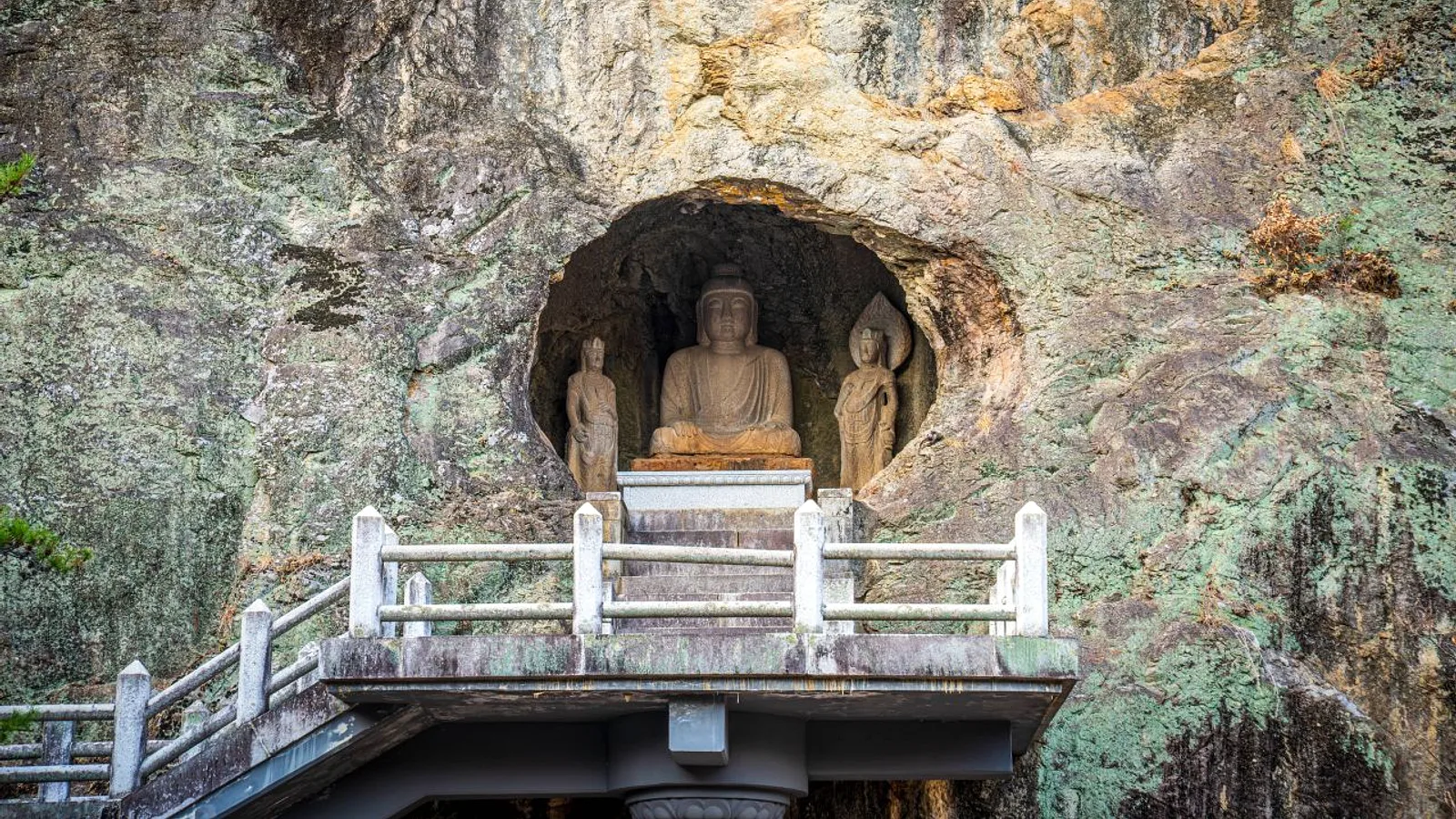
Namsan rises south of downtown Gyeongju and is part of the UNESCO-listed Gyeongju Historic Areas. It is often described as an open-air museum: along its valleys are dozens of Buddha carvings, rock reliefs, pagodas and temple ruins left by the Silla kingdom. Unlike a walled temple compound, the sites are scattered along real mountain trails, so the visit combines a hike with sightseeing. This guide focuses on the Samneung valley route, the classic half-day option for first-time visitors.
Why Namsan Is Different
Most heritage sites in Gyeongju are walked on flat ground. Namsan asks for more effort, and the reward is seeing Buddhist art in the setting it was made for: carved into boulders, tucked beside streams and placed on ridgelines. Many carvings are weathered, and some are damaged or incomplete. That is part of the experience, not a flaw in the visit.
The Samneung Valley Route
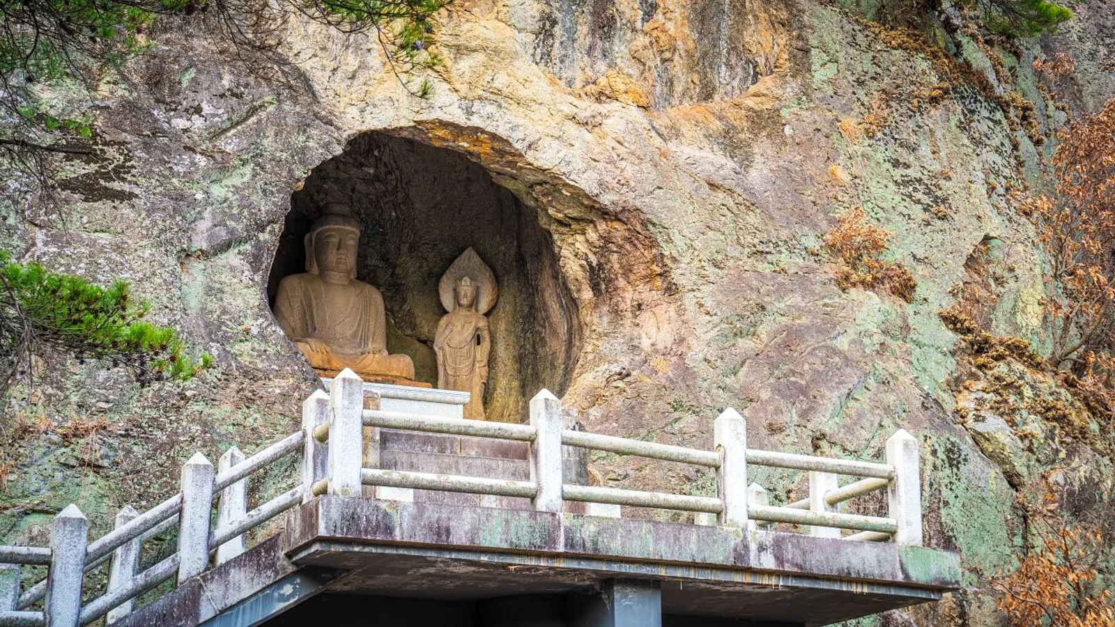
The standard route starts at the Samneung royal tombs, at the foot of the mountain, and climbs through the valley toward Geumobong peak. Along the way, hikers pass several key stops:
- The headless seated Buddha, a stone figure that has lost its head but still shows the carved body and posture.
- The Sangseonam rock carving, a relief cut into the rock face along the trail.
- Smaller reliefs, pagoda remains and temple ruins that appear beside the path.
- Geumobong peak, the high point of this route and a natural turnaround or continuation point.
Plan on roughly half a day for the full outing, including time at each stop. Check current trail maps on Naver Map or Kakao Map before starting, and confirm which trails are open.
Getting There
A bus runs from downtown Gyeongju to Samneung. Check the current route numbers and timetables on Naver Map or Kakao Map, since these can change. Samneung is a convenient meeting point because the royal tombs are an easy sight to see before or after the hike.
Poseokjeong Pavilion Site
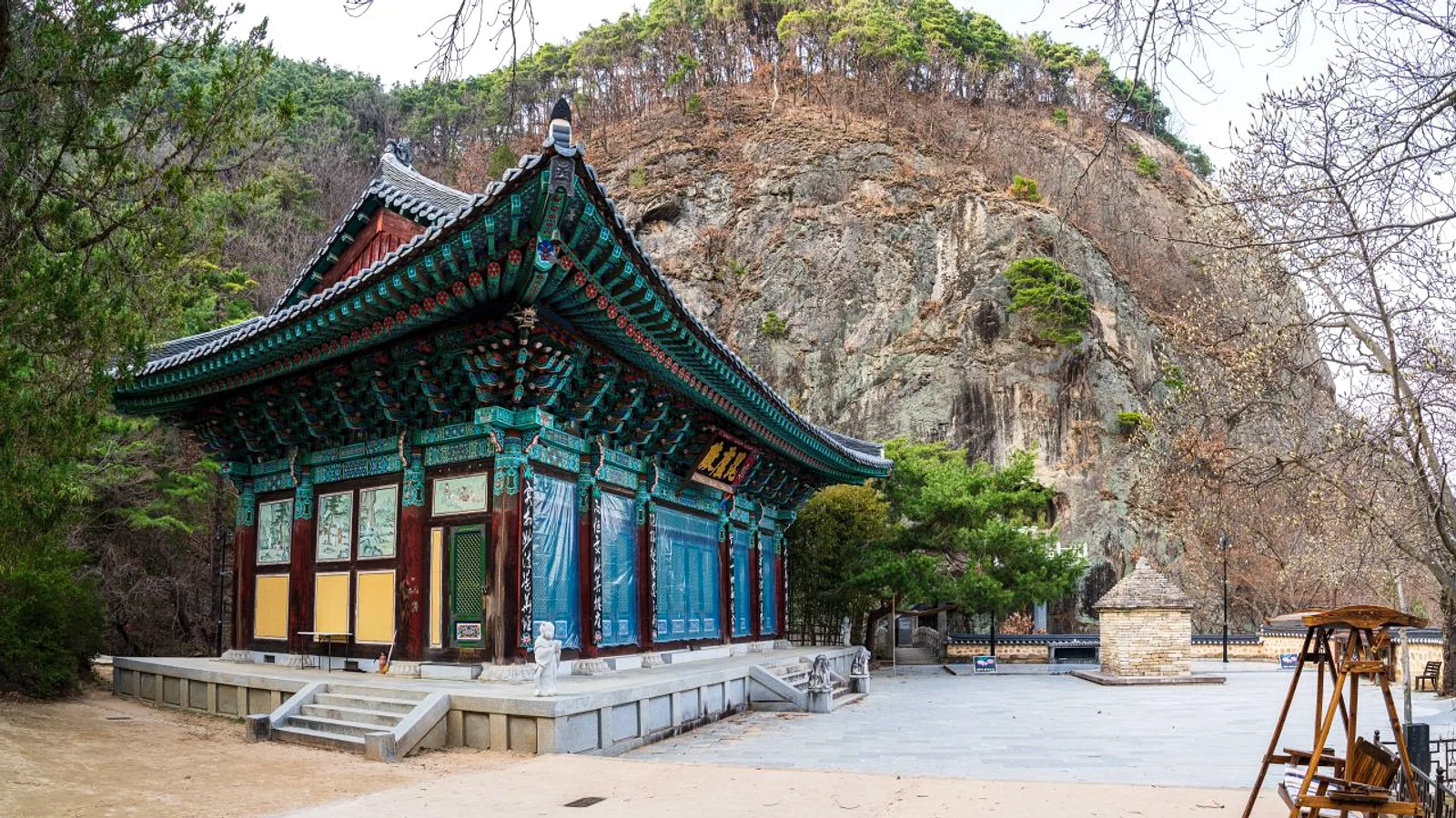
The Poseokjeong pavilion site lies at the foot of the mountain. It is a good addition for visitors who want a lower-effort stop, or for those who prefer to link a short walk with the hike. Check the official Gyeongju tourism site for current access details and any visiting restrictions.
What to Bring
Trails are rocky and uneven, and some sections are steep. Preparation matters more than speed.
- Sturdy shoes with good grip. Sandals and smooth-soled fashion sneakers are a poor choice.
- Enough water for the whole hike. Do not count on buying more on the mountain.
- A small snack, kept in a bag you can close. Carry out all trash.
- A hat, sun protection and a light layer, since conditions on the ridge can differ from the valley.
- A charged phone with an offline or downloaded map in case signal drops.
Etiquette and Safety
Many carvings are still objects of worship, and all of them are irreplaceable. Do not climb on, touch or rub the reliefs and statues. Keep to marked trails, especially near cliffs and loose rock. If weather turns wet, rock surfaces become slippery and the hike is better postponed. Because the route is a one-way climb in character, turn back if you are tired or daylight is short.
Tips
- Start early in the day to leave margin for slow stretches and to avoid the hottest hours in summer.
- Spring and autumn are generally the most comfortable seasons for walking. Check the weather forecast before going.
- Download an offline map and the route before leaving the city.
- Verify entry rules, trail closures and bus details on the official Gyeongju tourism site, Naver Map or Kakao Map.
- Travel light, keep hands free for balance, and allow extra time for photographs at the carvings.
- Decide your turnaround point in advance, so that you finish with energy left for the walk or bus ride back.